- Posts: 29
- Thank you received: 0
- Forum
- Open Forum
- Miscellaneous Research Topics
- General Airfield or 20th Century Military Architecture Discussion Topics
- 200 yard Moving Target Ranges
200 yard Moving Target Ranges
- Mattb
- Offline
- Junior Member
-

Less
More
28 Jan 2014 13:25 #271
by Mattb
I can remember this.
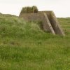
It's just about 50/50 sunken. concrete square pillbox type thing. Normal access to the west side..
Can't remember of any window or rifle holes
Replied by Mattb on topic 200 yard Moving Target Ranges
Just did, excellent!
So what's this then on Google Maps? Is it an air-to-ground markers shelter?
I can remember this.
It's just about 50/50 sunken. concrete square pillbox type thing. Normal access to the west side..
Can't remember of any window or rifle holes
Please Log in or Create an account to join the conversation.
- Adrian James
-

- Offline
- Senior Member
-

Less
More
- Posts: 157
- Thank you received: 8
17 Mar 2014 10:42 #272
by Adrian James
There is a a feature, very much like this, at Linney Head, Pembrokeshire - literally on Linney Head. I will dig up a picture and post. Would be very glad of your comments PNK! It is visible on Google Earth just North of the Lookout on the headland.
Replied by Adrian James on topic 200 yard Moving Target Ranges
Barrow 194?
This image is hidden for guests.
Please log in or register to see it.
There is a a feature, very much like this, at Linney Head, Pembrokeshire - literally on Linney Head. I will dig up a picture and post. Would be very glad of your comments PNK! It is visible on Google Earth just North of the Lookout on the headland.
Please Log in or Create an account to join the conversation.
- mawganmad
-

- Offline
- Platinum Member
-

Less
More
- Posts: 2807
- Thank you received: 18
17 Mar 2014 12:48 #273
by mawganmad
James Thomas
Replied by mawganmad on topic 200 yard Moving Target Ranges
Not the best thread for this but can't find it elsewhere and also for PNKs attention, appears to be a nice bombing circle just to the east at St Govan's Head www.flashearth.com/?lat=51.599693&lon=-4...&z=19.1&r=0&src="msl"
James Thomas
Please Log in or Create an account to join the conversation.
- Peter Kirk
-

- Offline
- Moderator
-

Less
More
- Posts: 12446
- Thank you received: 1029
17 Mar 2014 18:54 #274
by Peter Kirk
No Amount Of Evidence Will Ever Persuade An Idiot (probably not Mark Twain)
Replied by Peter Kirk on topic 200 yard Moving Target Ranges
Rerun57 - The feature I think you are referring looks to be too large and as this was an AFV training area (or was it arty?) it is unlikely a 200 yd MTR would have been contemplated here. From memory I don't think there was the associated RAF B&GS or AOS nearby.
Mawganmad - That is a Fleet Air Arm ORS target which was originally designed for photographic dive and R/P practice and I think we have discussed this before. The idea was that the camera took a shot at time of release of the imaginary bomb and the assessors, usually WRNS in the early post war era, and the shape of the circles would tell you the dive angle and the size, with the relevant lens data could tell you the range. Early intention was to include practice bombing but this was dropped post war. It is my belief that Treligga had the first example, being the air warfare school's range, but others appeared around FAA stations and this include some airfields such as Talbenny, Banff, Dallachy and Predannack (which is still visible). They were still in use in the fifties and probably into the sixties. The Americans used a similar design on their bombing range targets and even added circles to existing ranges when they took them over during the war but in their case they were purely to make the target more visible from high altitude.
Mawganmad - That is a Fleet Air Arm ORS target which was originally designed for photographic dive and R/P practice and I think we have discussed this before. The idea was that the camera took a shot at time of release of the imaginary bomb and the assessors, usually WRNS in the early post war era, and the shape of the circles would tell you the dive angle and the size, with the relevant lens data could tell you the range. Early intention was to include practice bombing but this was dropped post war. It is my belief that Treligga had the first example, being the air warfare school's range, but others appeared around FAA stations and this include some airfields such as Talbenny, Banff, Dallachy and Predannack (which is still visible). They were still in use in the fifties and probably into the sixties. The Americans used a similar design on their bombing range targets and even added circles to existing ranges when they took them over during the war but in their case they were purely to make the target more visible from high altitude.
No Amount Of Evidence Will Ever Persuade An Idiot (probably not Mark Twain)
Please Log in or Create an account to join the conversation.
- mawganmad
-
- Offline
- Platinum Member
-
Less
More
- Posts: 2807
- Thank you received: 18
17 Mar 2014 19:59 #275
by mawganmad
James Thomas
Replied by mawganmad on topic 200 yard Moving Target Ranges
Cheers Peter, thougt you would have seen it but couldn't find anything under that name search.
James Thomas
Please Log in or Create an account to join the conversation.
- PETERTHEEATER
-

- Offline
- Platinum Member
-
Less
More
- Posts: 10905
- Thank you received: 772
15 May 2014 08:56 #276
by PETERTHEEATER
Replied by PETERTHEEATER on topic 200 yard Moving Target Ranges
Can anyone suggest or state which airfields the Chesil Bank (Chickerell) MTR served?
Please Log in or Create an account to join the conversation.
- Peter Kirk
-
- Offline
- Moderator
-
Less
More
- Posts: 12446
- Thank you received: 1029
15 May 2014 12:06 #277
by Peter Kirk
No Amount Of Evidence Will Ever Persuade An Idiot (probably not Mark Twain)
Replied by Peter Kirk on topic 200 yard Moving Target Ranges
Chesil Bank was for the ATC/APC at Warmwell and Chickerell was the ELG/Drogue dropping field (originally). I don't think the MTRs were built for the armament camps, although a few were certainly on their ranges, as they were for AGS & AOS originally. I can't think of any in Dorset let alone neighbouring counties so was probably set up in 1939/40 prior to training moving North and West as the air threat increased. Training aircraft with no IFF would have been a major hassle for the radar operators at that time.
No Amount Of Evidence Will Ever Persuade An Idiot (probably not Mark Twain)
Please Log in or Create an account to join the conversation.
- PETERTHEEATER
-
- Offline
- Platinum Member
-
Less
More
- Posts: 10905
- Thank you received: 772
15 May 2014 14:22 #278
by PETERTHEEATER
Replied by PETERTHEEATER on topic 200 yard Moving Target Ranges
Thanks. I figured Warmwell to be a user but thought there might be at least one other.
Old Maps has a good 1957 2500 scale map cover of the MTR but I can't see any remains at all apart from a 'kinked' hedgeline.
Old Maps has a good 1957 2500 scale map cover of the MTR but I can't see any remains at all apart from a 'kinked' hedgeline.
Please Log in or Create an account to join the conversation.
- Movingtarget
-
- Offline
- Administrator
-

Less
More
- Posts: 63
- Thank you received: 8
16 May 2014 21:42 #279
by Movingtarget
Useful map - comparing it with current OS and Bing's Birds Eye view shows part of the original brick workshop building still there, just to the right of the modern grey/green farm building. Looks to me like the modern building was built on the base of the original central workshop area plus the apron. What's left looks just like the office areas at Theddlethorpe, see also my earlier post about Margam.
There's also a photo on Geograph , but it's not so easy to see. No idea what the small building is by the electricity poles, but it looks to be from the same era.
Any thoughts?
JohnG
Replied by Movingtarget on topic 200 yard Moving Target Ranges
....Old Maps has a good 1957 2500 scale map cover of the MTR but I can't see any remains at all apart from a 'kinked' hedgeline.
Useful map - comparing it with current OS and Bing's Birds Eye view shows part of the original brick workshop building still there, just to the right of the modern grey/green farm building. Looks to me like the modern building was built on the base of the original central workshop area plus the apron. What's left looks just like the office areas at Theddlethorpe, see also my earlier post about Margam.
There's also a photo on Geograph , but it's not so easy to see. No idea what the small building is by the electricity poles, but it looks to be from the same era.
Any thoughts?
JohnG
Please Log in or Create an account to join the conversation.
- Peter Kirk
-
- Offline
- Moderator
-
Less
More
- Posts: 12446
- Thank you received: 1029
17 May 2014 10:09 #280
by Peter Kirk
No Amount Of Evidence Will Ever Persuade An Idiot (probably not Mark Twain)
Replied by Peter Kirk on topic 200 yard Moving Target Ranges
Just looking back on this thread and noticed Ivor Jones' reply to ColinBa here
/community/showthread.php?2733-200-yard-Moving-Target-Ranges&p=104619&viewfull=1#post104619
Could this be the one of the Turret Ranges that we failed to identify and locate at places like Devils Punchbowl and Roman Hole?
Could this be the one of the Turret Ranges that we failed to identify and locate at places like Devils Punchbowl and Roman Hole?
No Amount Of Evidence Will Ever Persuade An Idiot (probably not Mark Twain)
Please Log in or Create an account to join the conversation.
- Forum
- Open Forum
- Miscellaneous Research Topics
- General Airfield or 20th Century Military Architecture Discussion Topics
- 200 yard Moving Target Ranges
Time to create page: 0.069 seconds
