- Posts: 1643
- Thank you received: 51
Another What's This?
- ted angus
- Offline
- Platinum Member
-

Less
More
01 Oct 2009 22:00 #21
by ted angus
Although it was back in 64/5 I did a stint at No 1 radio School Locking CADF was Commutated Antenna direction finder a small square building with 20ft mesh disc on top bearing a circular row of aerials. CADF were to be found around the countryside as well as on airfields.
CRDF was cathode Ray Direction Finder. I think this had 4 dipoles on a small brick building. CRDF & CADF differed in the frequency bands they operated in.
TED
Replied by ted angus on topic Another What's This?
I wasn't aware any one still was.
Regarding CRDF - the web tells me this stands for:
- Commutated Antenna / Aerial Direction Finder
- Communications and Acquisition Direction Finding
- Cathode-ray tube automatic direction finding
I suspect we are talking about the first one. I then found this comment after a Google search.
A new direction finder working on this band was eventually produced, known as CADF (commutated aerial D/F). A brick building with a 20ft diameter metal mesh disc on its roof appeared on all airfields.
This source has got to be 100% correct as I discovered the author was NP no less. Link here
What is strange about the building is that its four obstruction lights are mounted at roof level. Hence they would be below any aerial structure mounted on its top. Perhaps it wasn't a radio / radar facility at all?
Graham
Although it was back in 64/5 I did a stint at No 1 radio School Locking CADF was Commutated Antenna direction finder a small square building with 20ft mesh disc on top bearing a circular row of aerials. CADF were to be found around the countryside as well as on airfields.
CRDF was cathode Ray Direction Finder. I think this had 4 dipoles on a small brick building. CRDF & CADF differed in the frequency bands they operated in.
TED
Please Log in or Create an account to join the conversation.
- mawganmad
-

- Offline
- Platinum Member
-
Less
More
- Posts: 2807
- Thank you received: 18
02 Oct 2009 08:28 #22
by mawganmad
Wrong, it's Cathode-ray Range and Direction Finding.
'A new direction finder working on this band was eventually produced, known as CADF (commutated aerial D/F). A brick building with a 20ft diameter metal mesh disc on its roof appeared on all airfields.'
The building described there is DRDF (certainly to the RAF), which still appears on some RAF stations.
I'm 100% convinced that the building in the original pic is a CRDF, possibly with a newer aerial. Positioning of lights on roof could be due to their fitting on actual antenna causing electrical and physical interference to it.
The red and white squares would also inferr the building was radio aids, and ad hoc brick buildings don't just appear on airfields.
The
James Thomas
Replied by mawganmad on topic Another What's This?
Regarding CRDF - the web tells me this stands for:
Commutated Antenna / Aerial Direction Finder
Communications and Acquisition Direction Finding
Cathode-ray tube automatic direction finding
I suspect we are talking about the first one. I then found this comment after a Google search.
A new direction finder working on this band was eventually produced, known as CADF (commutated aerial D/F). A brick building with a 20ft diameter metal mesh disc on its roof appeared on all airfields.
This source has got to be 100% correct as I discovered the author was NP no less
What is strange about the building is that its four obstruction lights are mounted at roof level. Hence they would be below any aerial structure mounted on its top. Perhaps it wasn't a radio / radar facility at all?
Graham
Wrong, it's Cathode-ray Range and Direction Finding.
'A new direction finder working on this band was eventually produced, known as CADF (commutated aerial D/F). A brick building with a 20ft diameter metal mesh disc on its roof appeared on all airfields.'
The building described there is DRDF (certainly to the RAF), which still appears on some RAF stations.
I'm 100% convinced that the building in the original pic is a CRDF, possibly with a newer aerial. Positioning of lights on roof could be due to their fitting on actual antenna causing electrical and physical interference to it.
The red and white squares would also inferr the building was radio aids, and ad hoc brick buildings don't just appear on airfields.
The
James Thomas
Please Log in or Create an account to join the conversation.
- Paul Francis
-

- Offline
- Moderator
-

Less
More
- Posts: 5843
- Thank you received: 567
02 Oct 2009 08:56 #23
by Paul Francis
You can tell a builder from an archaeologist by the size of his trowel. Mine is a small one!
Replied by Paul Francis on topic Another What's This?
Ah well MM you must be right then!!
You can tell a builder from an archaeologist by the size of his trowel. Mine is a small one!
Please Log in or Create an account to join the conversation.
- Jim Hope
- Offline
- Senior Member
-

Less
More
- Posts: 190
- Thank you received: 7
10 Oct 2009 16:16 #24
by Jim Hope
Replied by Jim Hope on topic Another What's This?
CRDF - Cathode Ray Direction Finder had four aerials - one for N-S-E-and W in a double H type layout, you used to see them on houses years ago, and the sense aerial in the middle. Used in the old VHF frequency range.The aerials were several feet above the building. CADF - Commutated Aerial Direction Finder had eighteen dipole aerials one wavelength apart on top of a twenty foot diameter mesh shield. The "Test" aerial was on top of a wooden pole about thirty feet from the building, and worked in the "new" UHF frequency range. The ATC bods said they could tell the range of an aircraft from CRDF/CADF. Our reply was "Oh can you sir" then we would wander off laughing like hyenas. The CADF building was still standing at Swinderby a few weeks ago although the roof was being used as a convenient rubbish dump, and Newton's was still there up to three years ago.
Please Log in or Create an account to join the conversation.
- dai1986
- Offline
- New Member
-

Less
More
- Posts: 5
- Thank you received: 0
10 Oct 2009 20:18 #25
by dai1986
Replied by dai1986 on topic Another What's This?
I work at Marshall Aerospace, i can find out if you are all still interested!!
Please Log in or Create an account to join the conversation.
- Paul Francis
-
- Offline
- Moderator
-
Less
More
- Posts: 5843
- Thank you received: 567
10 Oct 2009 20:27 #26
by Paul Francis
You can tell a builder from an archaeologist by the size of his trowel. Mine is a small one!
Replied by Paul Francis on topic Another What's This?
I work at Marshall Aerospace, i can find out if you are all still interested!!
Yes please!
Yes please!
You can tell a builder from an archaeologist by the size of his trowel. Mine is a small one!
Please Log in or Create an account to join the conversation.
- dai1986
- Offline
- New Member
-
Less
More
- Posts: 5
- Thank you received: 0
10 Oct 2009 22:47 #27
by dai1986
Replied by dai1986 on topic Another What's This?
il try and get an answer during the week.
Please Log in or Create an account to join the conversation.
- historymadd
- Offline
- Junior Member
-

Less
More
- Posts: 71
- Thank you received: 1
05 Jan 2010 20:43 #28
by historymadd
hi there
the ils buildings at raf abingdon are witinthe airfield grass areas just for information
just wondered if this sort of stuff could have been used on a landrover as there are pictures of hf landrovers being dotted around the airfield to aid incoming aircraft
??????????
cheers
#
Replied by historymadd on topic Another What's This?
Bill,
It looks like an Inner Marker beacon for the ILS, but....
a) The IM is normally just outside the airfield - the pic suggests it is too close to the airfield.
b) Why is the antenna at some strange angle. Two possibilities:
With the old wartime SBA system the Main Beacon had vertical aerial elements, and the aircraft had a vertical aerial to receive this. The SBA Inner and Outer markers had horizontal elements, and the aircraft was equipped with a horizontal rod antenna - often described as a 'handrail'.
- It's fallen over
- It has been configured for mixed polarity.
Then along came VHF BA for using in single-seat fighters, using only the aircraft's R/T set. The aircraft R/T aerial was a vertical element and was therefore insensitive to horizontally-polarised marker beacons. They didn't want to add an extra horizontal aerial to the fighter, so the solution was to move the ground marker beacons well to the side of the runway centre-line axis, and angle their antennas accordingly. An angle of 45 degrees would be optimal. A far from ideal solution but necessary at the time.
Having said all that Option 1 above seems likely.
Where is the device physically located?
Graham
hi there
the ils buildings at raf abingdon are witinthe airfield grass areas just for information
just wondered if this sort of stuff could have been used on a landrover as there are pictures of hf landrovers being dotted around the airfield to aid incoming aircraft
??????????
cheers
#
Please Log in or Create an account to join the conversation.
- cbrjock
-

- Offline
- Premium Member
-

Less
More
- Posts: 594
- Thank you received: 6
11 Mar 2011 06:54 #29
by cbrjock
Replied by cbrjock on topic Another What's This?
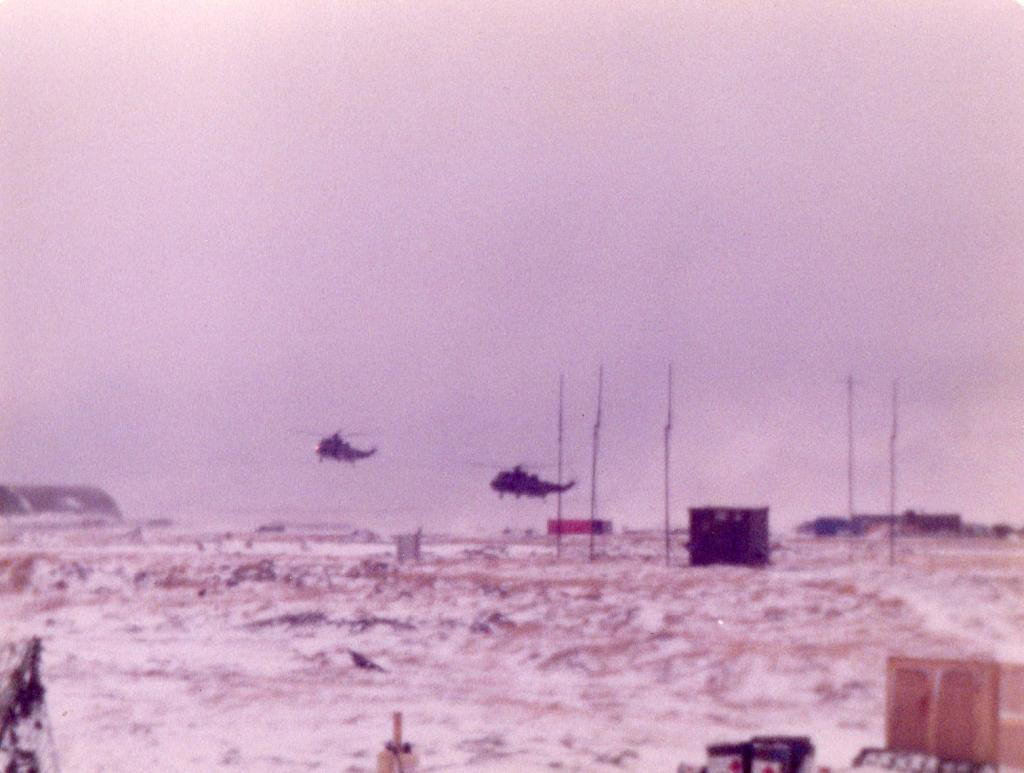
Just found this (rather poor) shot of the mobile CRDF we had at Stanley in '84.
This image is hidden for guests.
This image is hidden for guests.
Please log in or register to see it.
Please Log in or Create an account to join the conversation.
- 698
-

- Offline
- Senior Member
-
Less
More
- Posts: 299
- Thank you received: 28
01 Jan 2012 13:13 #30
by 698
Replied by 698 on topic Another What's This?
Hi there.
First posting on the forum.
I can't say what this is but there used to be a similar contraption by the side of the A329 between Great Milton and the M40 in Oxfordshire.
However this construction had two antennas back to back, mounted horizontally, and from memory, possibly smaller.
The Cambridge one is vertical by the look of it.
The antennas by the A329 pointed, roughly, NNW and SSE.
Pictures from Google Earth/Google maps
[IMG]/community/92664=7280-What is it.jpg[/img]
[IMG]/community/92664=7281-thingy by side of A329.jpg[/img]
698
First posting on the forum.
I can't say what this is but there used to be a similar contraption by the side of the A329 between Great Milton and the M40 in Oxfordshire.
However this construction had two antennas back to back, mounted horizontally, and from memory, possibly smaller.
The Cambridge one is vertical by the look of it.
The antennas by the A329 pointed, roughly, NNW and SSE.
Pictures from Google Earth/Google maps
[IMG]/community/92664=7280-What is it.jpg[/img]
[IMG]/community/92664=7281-thingy by side of A329.jpg[/img]
698
Anyone know what this is? Seen on the airfield at Cambridge, seemingly now known as Cambridge City Airport as opposed to Marshall's Cambridge Airport.
This image is hidden for guests.
Please log in or register to see it.
Please Log in or Create an account to join the conversation.
Time to create page: 0.063 seconds

![[IMG]/community/92664=7280-What is it.jpg[/img]](/community/92664=7280-What%20is%20it.jpg)
![[IMG]/community/92664=7281-thingy by side of A329.jpg[/img]](/community/92664=7281-thingy%20by%20side%20of%20A329.jpg)